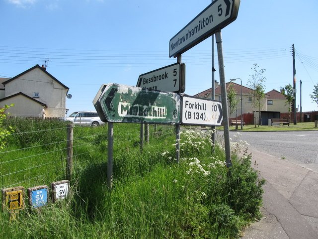
Defaced road direction signs at Whitecross Crossroads
Introduction
The photograph on this page of Defaced road direction signs at Whitecross Crossroads by Eric Jones as part of the Geograph project.
The Geograph project started in 2005 with the aim of publishing, organising and preserving representative images for every square kilometre of Great Britain, Ireland and the Isle of Man.
There are currently over 7.5m images from over 14,400 individuals and you can help contribute to the project by visiting https://www.geograph.org.uk

Image: © Eric Jones Taken: 3 Jun 2016
Whitecross, itself a predominantly Nationalist community, stands on a sectarian fracture zone between the dyed in the wool Nationalist and Republican areas of South Armagh and the equally dyed in the wool Loyalist and Unionist areas of North Armagh. The villages of Forkhill and Markethill epitomise the communities on either side of the divide, 94.6% of the population of Forkhill are of a Catholic background, while 82.9% of Markethill's population are of a Protestant background.

