Farm buildings, Hatch
Introduction
The photograph on this page of Farm buildings, Hatch by Derek Harper as part of the Geograph project.
The Geograph project started in 2005 with the aim of publishing, organising and preserving representative images for every square kilometre of Great Britain, Ireland and the Isle of Man.

There are currently over 7.5m images from over 14,400 individuals and you can help contribute to the project by visiting https://www.geograph.org.uk
Farm buildings, Hatch
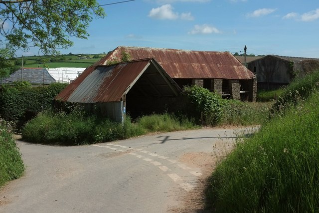
Image: © Derek Harper Taken: 8 Jun 2016
Part hidden is the shippon seen end on in Image], here showing its open bays and "rough stone piers" https://www.historicengland.org.uk/listing/the-list/list-entry/1168827 . On this side of it is the "attached barn or linhay". Part of the courtyard group (see Image]) is being re-roofed.
Images are licensed for reuse under creativecommons.org/licenses/by-sa/2.0
Image Location


Leaflet Map data © OpenStreetMap
Latitude
50.307537
Longitude
-3.812925