Gloucester House
Introduction
The photograph on this page of Gloucester House by Des Blenkinsopp as part of the Geograph project.
The Geograph project started in 2005 with the aim of publishing, organising and preserving representative images for every square kilometre of Great Britain, Ireland and the Isle of Man.

There are currently over 7.5m images from over 14,400 individuals and you can help contribute to the project by visiting https://www.geograph.org.uk
Gloucester House
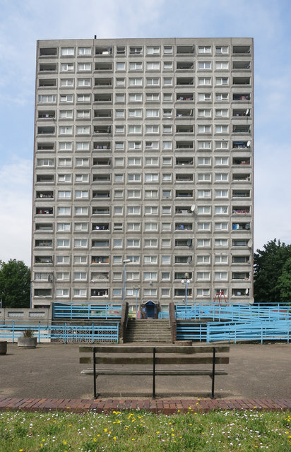
Image: © Des Blenkinsopp Taken: 8 Jun 2016
Gloucester House is an 18 storey tower block on the South Kilburn Estate in Brent, West London. It was approved in 1966 and is 51m tall. It is at the heart of an area scheduled for the South Kilburn Regeneration Programme. http://newlondondevelopment.com/nld/project/gloucester_house_and_durham_court_south_kilburn_regeneration_programme_phase_2b
Images are licensed for reuse under creativecommons.org/licenses/by-sa/2.0
Image Location
Latitude
51.532655
Longitude
-0.195809