Dried-up pool at Hilbrae
Introduction
The photograph on this page of Dried-up pool at Hilbrae by Richard Law as part of the Geograph project.
The Geograph project started in 2005 with the aim of publishing, organising and preserving representative images for every square kilometre of Great Britain, Ireland and the Isle of Man.

There are currently over 7.5m images from over 14,400 individuals and you can help contribute to the project by visiting https://www.geograph.org.uk
Dried-up pool at Hilbrae
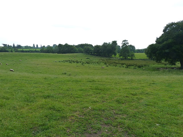
Image: © Richard Law Taken: 11 Jun 2016
This shallow depression with the marsh grass at its centre yelled "Kettle Hole" at me as I walked past - a kettle hole being a pool or lake which forms as a result of a block of ice being left behind after the melting of a glacier, and which leaves a hole in the moraine that subsequently fills with water. They are fairly commonplace in north Shropshire and south Cheshire; this one has more or less dried up, but is still marked as standing water on the 1:25000 map.
Images are licensed for reuse under creativecommons.org/licenses/by-sa/2.0
Image Location
Latitude
52.791503
Longitude
-2.549673