Information board, Magheralin
Introduction
The photograph on this page of Information board, Magheralin by Kenneth Allen as part of the Geograph project.
The Geograph project started in 2005 with the aim of publishing, organising and preserving representative images for every square kilometre of Great Britain, Ireland and the Isle of Man.

There are currently over 7.5m images from over 14,400 individuals and you can help contribute to the project by visiting https://www.geograph.org.uk
Information board, Magheralin
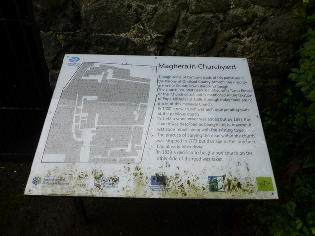
Image: © Kenneth Allen Taken: 7 Jun 2016
The following text is included in the description: Though some of the town lands of this parish are in the Barony of Oneiland County Armagh, the majority are in the County Down Barony of Iveagh. The church has itself been identified with "Lann Ronan" or the 'Church of Ian' and is mentioned in the taxation of Pope Nicholas of 1306 although today there are no traces of this medieval Church. In 1400 a new church was built incorporating parts of the previous church. In 1442 a stone tower was added but by 1657 the church was described as being in ruins, however it was soon rebuilt along with the existing tower. The practice of burying the dead within the church was stopped in 1773 but damage to the structure had already been done. In 1839 a decision to build a new church on the other side of the road was taken. Pictured here Image]
Images are licensed for reuse under creativecommons.org/licenses/by-sa/2.0
Image Location
Latitude
54.466496
Longitude
-6.26045