Development, Blackfriars Road
Introduction
The photograph on this page of Development, Blackfriars Road by Stephen Richards as part of the Geograph project.
The Geograph project started in 2005 with the aim of publishing, organising and preserving representative images for every square kilometre of Great Britain, Ireland and the Isle of Man.

There are currently over 7.5m images from over 14,400 individuals and you can help contribute to the project by visiting https://www.geograph.org.uk
Development, Blackfriars Road
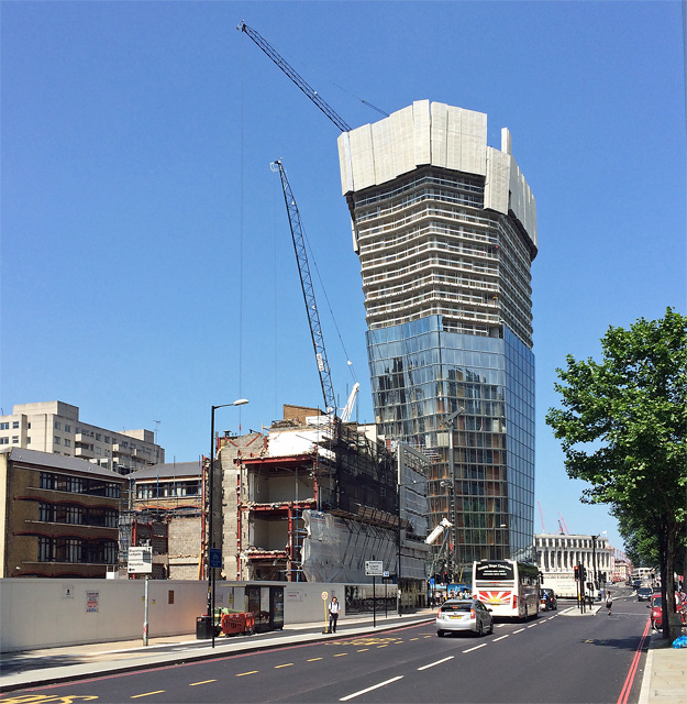
Image: © Stephen Richards Taken: 6 Jun 2016
This is One Blackfriars, "a beacon of architectural brilliance" according to the developers, Berkeley Group. Or one of countless strutting incursions into London's skyscape, liberally scattered around like seeds on the wind. This one's gimmick is that it starts off thin, gets fatter in the middle, and then gets thin again at the top (see also the theory of Anne Elk). It will be fifty storeys in all and contain flats valued at £1m to £23m. Berkeley exercised its right to pay Southwark Council in lieu of providing affordable flats. On the left are the last remnants of this group Image], to be replaced with yet more glass towers, 20 Blackfriars Road.
Images are licensed for reuse under creativecommons.org/licenses/by-sa/2.0
Image Location
Latitude
51.50757
Longitude
-0.104863