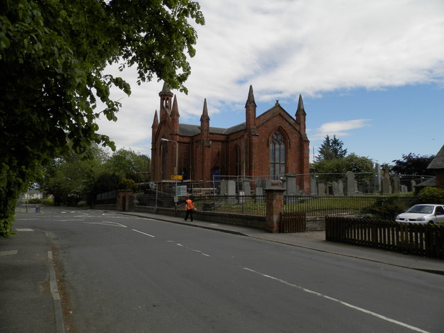
Inchture Parish Church
Introduction
The photograph on this page of Inchture Parish Church by Douglas Nelson as part of the Geograph project.
The Geograph project started in 2005 with the aim of publishing, organising and preserving representative images for every square kilometre of Great Britain, Ireland and the Isle of Man.
There are currently over 7.5m images from over 14,400 individuals and you can help contribute to the project by visiting https://www.geograph.org.uk

Image: © Douglas Nelson Taken: 2 Jun 2016
The existence of a Parish Church in Inchture dates from the 12th century when William the Lion granted a small chapel at Inchture the status of a Parish Church. In 1799, a meeting of heritors discussed the state of the building which necessitated extensive repairs and alterations. The state of the building was so bad that a new church was built in 1834. It was at this time the church building and the churchyard were elevated about 2 metres above the surrounding level. A local red sandstone was used. The church was destroyed in a fire in 1890 and the present building was completed the following year.

