Road junction
Introduction
The photograph on this page of Road junction by Lairich Rig as part of the Geograph project.
The Geograph project started in 2005 with the aim of publishing, organising and preserving representative images for every square kilometre of Great Britain, Ireland and the Isle of Man.

There are currently over 7.5m images from over 14,400 individuals and you can help contribute to the project by visiting https://www.geograph.org.uk
Road junction
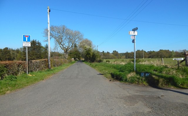
Image: © Lairich Rig Taken: 9 May 2016
As the map shows, there is a crossroads here. The road leading to the left (north), and the one behind the photographer (west), are part of a local route called the Horseshoe. The road to the right (south, Image) leads to Merkins Farm. The road straight ahead (east) leads to Wester Cameron, and to a track across Cameron Muir. Since March 2016, it has also been part of a new section of the John Muir Way. As markers on the signpost now indicate, that route enters from the left, and continues straight ahead. The John Muir Way and the track across Cameron Muir both follow that road until the point shown in Image, where they go their separate ways.
Images are licensed for reuse under creativecommons.org/licenses/by-sa/2.0
Image Location
Latitude
56.01517
Longitude
-4.504395