Old Brewery House, High Street, Steyning
Introduction
The photograph on this page of Old Brewery House, High Street, Steyning by Simon Carey as part of the Geograph project.
The Geograph project started in 2005 with the aim of publishing, organising and preserving representative images for every square kilometre of Great Britain, Ireland and the Isle of Man.

There are currently over 7.5m images from over 14,400 individuals and you can help contribute to the project by visiting https://www.geograph.org.uk
Old Brewery House, High Street, Steyning
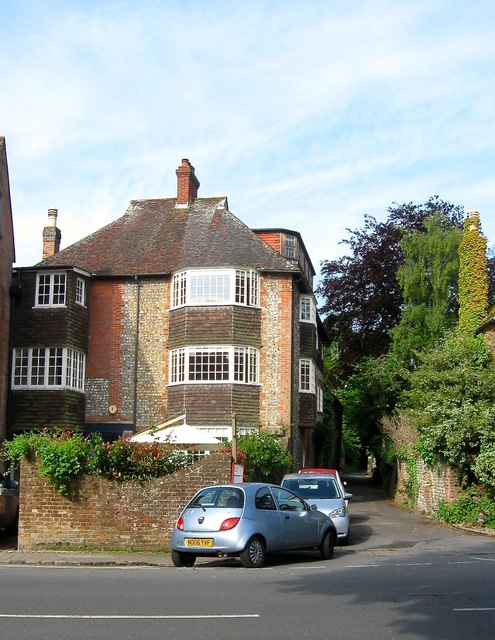
Image: © Simon Carey Taken: 29 May 2016
Located on the corner of Dog Lane the current house has been converted from the old brewery building. A date stone on the wall gives the date 1772 and the title 'Stoveld' was the name of the brewery. There are records of a brewery operating on or near the site in 1692, however, this brewery operated from the 1770s through to the 1920s. Known as Stovolds then Mitchells, it amalgamated with nearby Gates's (See Image) in 1899 to become Steyning Breweries. This in turn was taken over by Rock Brewery of Brighton in 1927 who closed operations soon after, neither brewery buildings were marked on the 1932 OS map. Whereas Gates's old buildings were demolished, this one survived and was converted into a residence. Originally called Old Brewery House it was for a while known as Rosewall Cottage but has now reverted to its original name.
Images are licensed for reuse under creativecommons.org/licenses/by-sa/2.0
Image Location
Latitude
50.887123
Longitude
-0.327068