Sandy Bay
Introduction
The photograph on this page of Sandy Bay by Stephen McKay as part of the Geograph project.
The Geograph project started in 2005 with the aim of publishing, organising and preserving representative images for every square kilometre of Great Britain, Ireland and the Isle of Man.
There are currently over 7.5m images from over 14,400 individuals and you can help contribute to the project by visiting https://www.geograph.org.uk

Image: © Stephen McKay Taken: 28 May 2016
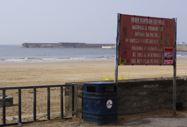
Mackworth Road ends here at the beach, marked by a battered sign still bearing the name Ogwr Borough Council. This is strange because that council was absorbed into Bridgend County Borough in 1996, 20 years ago. In fact the sign is barely legible, despite it important message, and has been used to mount a poster about rubbish. Nowadays an official sign of this nature would have to be bilingual.

