North Wales WWII defences: Deganwy - loopholed wall (1)
Introduction
The photograph on this page of North Wales WWII defences: Deganwy - loopholed wall (1) by Mike Searle as part of the Geograph project.
The Geograph project started in 2005 with the aim of publishing, organising and preserving representative images for every square kilometre of Great Britain, Ireland and the Isle of Man.

There are currently over 7.5m images from over 14,400 individuals and you can help contribute to the project by visiting https://www.geograph.org.uk
North Wales WWII defences: Deganwy - loopholed wall (1)
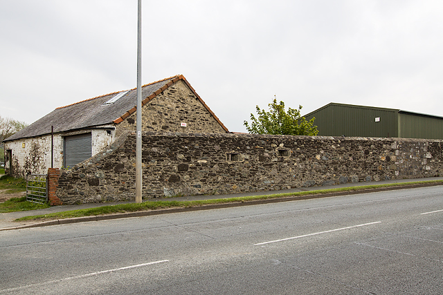
Image: © Mike Searle Taken: 10 May 2016
- Loopholed wall: DoB ID: S0015613 Located along the A546 at Deganwy, the wall faces west, and incorporates a pair of loopholes overlooking the open ground between the sea and the road now occupied by a golf course. Image
Images are licensed for reuse under creativecommons.org/licenses/by-sa/2.0
Image Location
Latitude
53.310417
Longitude
-3.831506