Temple Roofline
Introduction
The photograph on this page of Temple Roofline by Des Blenkinsopp as part of the Geograph project.
The Geograph project started in 2005 with the aim of publishing, organising and preserving representative images for every square kilometre of Great Britain, Ireland and the Isle of Man.

There are currently over 7.5m images from over 14,400 individuals and you can help contribute to the project by visiting https://www.geograph.org.uk
Temple Roofline
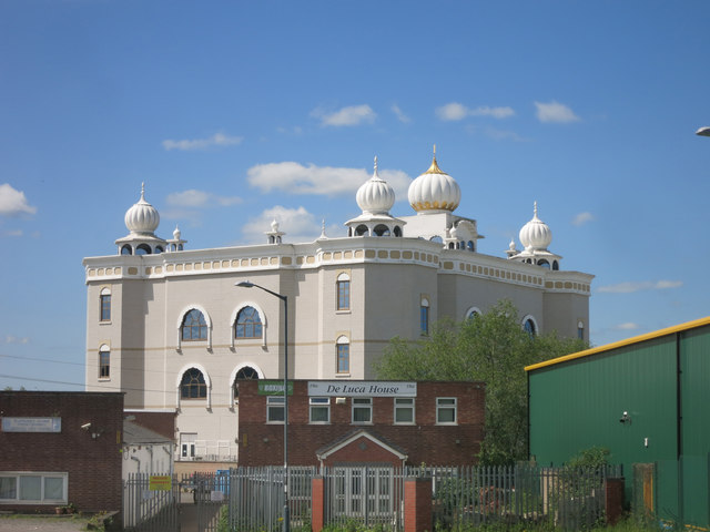
Image: © Des Blenkinsopp Taken: 24 May 2016
The entrance to the Gurdwara Sahib Sikh Temple is on Tachbrook Park Drive on the other side of the building. The Temple was completed in 2009. http://www.gurdwara-leamingtonandwarwick.com This is not the best side to view it from, but this is where I was so it will have to do.
Images are licensed for reuse under creativecommons.org/licenses/by-sa/2.0
Image Location


Leaflet Map data © OpenStreetMap
Latitude
52.278221
Longitude
-1.544996