Worminghall Village Hall
Introduction
The photograph on this page of Worminghall Village Hall by John S Turner as part of the Geograph project.
The Geograph project started in 2005 with the aim of publishing, organising and preserving representative images for every square kilometre of Great Britain, Ireland and the Isle of Man.

There are currently over 7.5m images from over 14,400 individuals and you can help contribute to the project by visiting https://www.geograph.org.uk
Worminghall Village Hall
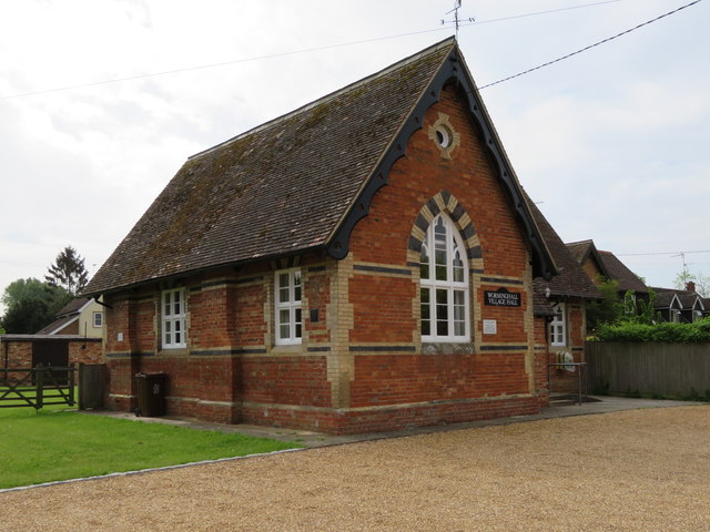
Image: © John S Turner Taken: 27 May 2016
Worminghall Village Hall used to be the village school. A school existed in Worminghall as far back as the 1820s, set up by Viscountess Clifden, but I don't know if it was in this building. There is an Ordnance Survey bench mark on the corner of the building nearest the camera - Image
Images are licensed for reuse under creativecommons.org/licenses/by-sa/2.0
Image Location
Latitude
51.769776
Longitude
-1.06884