Scorton
Introduction
The photograph on this page of Scorton by Mick Garratt as part of the Geograph project.
The Geograph project started in 2005 with the aim of publishing, organising and preserving representative images for every square kilometre of Great Britain, Ireland and the Isle of Man.

There are currently over 7.5m images from over 14,400 individuals and you can help contribute to the project by visiting https://www.geograph.org.uk
Scorton
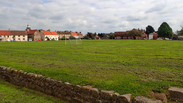
Image: © Mick Garratt Taken: 28 May 2016
Headed west for a change. A cycling foray into the flat farmlands of the Vale of Mowbray. Sir Nikolaus Pevsner (1902-1983), the renowned architectural writer, described Scorton as having “a rather large, somewhat shapeless green”. But it is an unusual green in the fact that it is raised higher than the rest of the village. There are only two such other raised village greens in the whole of England (but another source does say there are actually three). The green was at one time the village rubbish tip before it was levelled and the wall built around it. It is surrounded by a one way system of the B1263 but is used regularly for cricket and football. Just don’t score a six or kick the ball out of touch. The name Scorton is Anglo-Saxon. It was referred to as Scoretone in the Domesday Book. The ‘ton’ suffix is from the Old English tun for a farm or settlement. Opinion is divided about the origin of the scor element. One thought is that it meant short, as opposed the nearby village of Langton or ‘Long Tun’. Alternately it could come from the Old Norse word skor, meaning a rift in the rock or ravine. This hybridisation of Anglo-Saxon and Scandinavian names is not unusual. There are several examples in North Yorkshire. But I can not see where the ravine is around here. The village was at one time home to two well known institutions. The Hospital of St John of God was founded in 1880 on the grounds of the former convent of St Clare. The current building was built in 1912/13. The chimneys can be seen in the photo on the skyline just left of the two trees. It is now a care home.
Images are licensed for reuse under creativecommons.org/licenses/by-sa/2.0
Image Location


Leaflet Map data © OpenStreetMap
Latitude
54.396211
Longitude
-1.615228