The John Muir Way near Carbeth Huts
Introduction
The photograph on this page of The John Muir Way near Carbeth Huts by Lairich Rig as part of the Geograph project.
The Geograph project started in 2005 with the aim of publishing, organising and preserving representative images for every square kilometre of Great Britain, Ireland and the Isle of Man.

There are currently over 7.5m images from over 14,400 individuals and you can help contribute to the project by visiting https://www.geograph.org.uk
The John Muir Way near Carbeth Huts
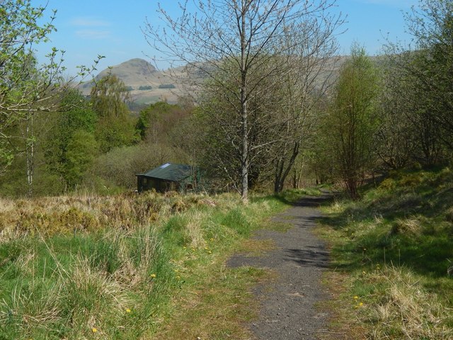
Image: © Lairich Rig Taken: 9 May 2016
The view is from about the same place as Image, but in the opposite direction. One example of a hut can be seen, with Dumgoyne (Image) on the skyline behind it. The settlement of the Carbeth Hutters might be said to have had its roots in the summer camps organised here by the Clarion Scouts, a socialist movement, before the First World War. From those beginnings, the nature of the settlements gradually evolved in response to social changes.
Images are licensed for reuse under creativecommons.org/licenses/by-sa/2.0
Image Location
Latitude
55.983544
Longitude
-4.358061