Cloberfield Open Space
Introduction
The photograph on this page of Cloberfield Open Space by Lairich Rig as part of the Geograph project.
The Geograph project started in 2005 with the aim of publishing, organising and preserving representative images for every square kilometre of Great Britain, Ireland and the Isle of Man.

There are currently over 7.5m images from over 14,400 individuals and you can help contribute to the project by visiting https://www.geograph.org.uk
Cloberfield Open Space
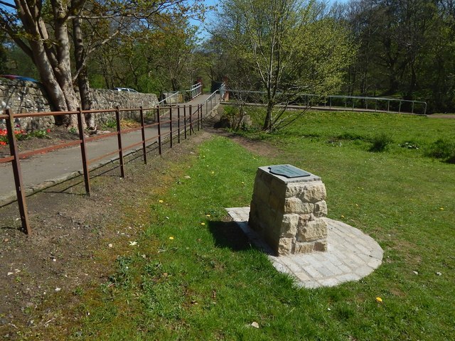
Image: © Lairich Rig Taken: 9 May 2016
This is the northern end of the area. For a view in the opposite direction, see Image The structure visible in both pictures had a plaque on it, with the words "Allander Park & Cloberfield Open Space"; this open space is considered a part of Allander Park, which was designated a Centenary Field in 2014, commemorating those who died in the First World War. The Allander Water is ahead, behind the railings on the right. See a view south from there: Image As the 1:25000 map shows, there is, between the river and the photographer's position, a much narrower water channel, visible in the present picture.
Images are licensed for reuse under creativecommons.org/licenses/by-sa/2.0
Image Location
Latitude
55.946826
Longitude
-4.322834