Ashfield Road, Rochdale, Lancashire
Introduction
The photograph on this page of Ashfield Road, Rochdale, Lancashire by Dr Neil Clifton as part of the Geograph project.
The Geograph project started in 2005 with the aim of publishing, organising and preserving representative images for every square kilometre of Great Britain, Ireland and the Isle of Man.

There are currently over 7.5m images from over 14,400 individuals and you can help contribute to the project by visiting https://www.geograph.org.uk
Ashfield Road, Rochdale, Lancashire
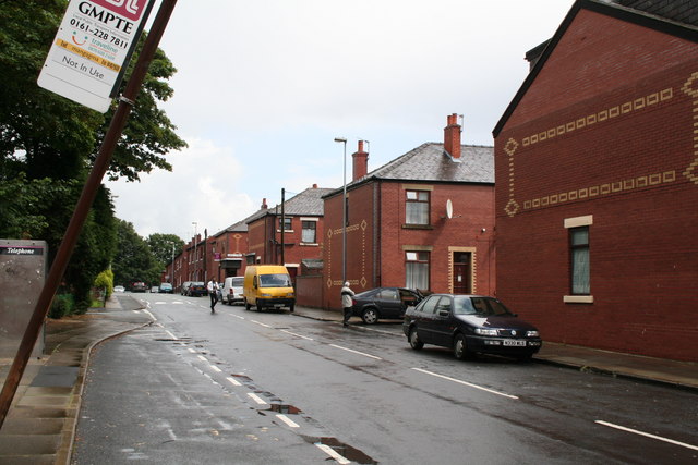
Image: © Dr Neil Clifton Taken: 9 Jul 2007
This is looking northwards from Deeplish Corner, and shows the junctions of Ashfield Road with Ventnor Street and Aubrey Street. The decorative brickwork on the terrace ends is of recent origin. The tilting bus stop sign is of significance - it states 'out of use'. There is no bus service whatever now into the Deeplish district. Interestingly enough, this is the route of Rochdale Corporation's very first bus service. Back in the 1920s, the corporation was a tramway operator, but trams would not have been suitable in Deeplish with its narrow roads and awkward street layout. So a motorbus service was started, and appropriately enough, was given service No 1. It ran for very many years, usually at a 10 minute frequency, surviving into the SELNEC and GMPTE eras (although renumbered). But now it has gone with only a few disused bus stops to recall its existence.
Images are licensed for reuse under creativecommons.org/licenses/by-sa/2.0
Image Location
Latitude
53.606256
Longitude
-2.157137