Lazonby & Kirkoswald station
Introduction
The photograph on this page of Lazonby & Kirkoswald station by Richard Vince as part of the Geograph project.
The Geograph project started in 2005 with the aim of publishing, organising and preserving representative images for every square kilometre of Great Britain, Ireland and the Isle of Man.

There are currently over 7.5m images from over 14,400 individuals and you can help contribute to the project by visiting https://www.geograph.org.uk
Lazonby & Kirkoswald station
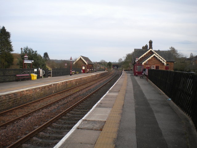
Image: © Richard Vince Taken: 10 Apr 2016
Looking towards Leeds from the Down platform. The station is actually in the middle of Lazonby; Kirkoswald is a similar sized settlement about a mile to the north east. When this picture was taken, no trains were running between Appleby and Carlisle due to flood damage, hence the rusty rails. In the distance, it is possible to see right through the short, straight Lazonby Tunnel.
Images are licensed for reuse under creativecommons.org/licenses/by-sa/2.0
Image Location
Latitude
54.750747
Longitude
-2.703758