The centre of Droylsden
Introduction
The photograph on this page of The centre of Droylsden by Gerald England as part of the Geograph project.
The Geograph project started in 2005 with the aim of publishing, organising and preserving representative images for every square kilometre of Great Britain, Ireland and the Isle of Man.

There are currently over 7.5m images from over 14,400 individuals and you can help contribute to the project by visiting https://www.geograph.org.uk
The centre of Droylsden
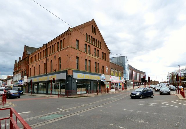
Image: © Gerald England Taken: 23 Apr 2016
The large building on the corner of Market Street and Manchester Road is Wharf Point which was formerly the Co-operative Hall built in 1876 Image Behind is the newly built Guardsman Tony Downes House home of the Greater Manchester Pension Fund. On the left is a Stagecoach bus on the #7 route from Stockport to Ashton under Lyne via Reddish, Abbey Hey and Gorton. In the foreground are the Metrolink tram lines.
Images are licensed for reuse under creativecommons.org/licenses/by-sa/2.0
Image Location
Latitude
53.479265
Longitude
-2.145968