Nottingham skyline from Sneinton
Introduction
The photograph on this page of Nottingham skyline from Sneinton by John Sutton as part of the Geograph project.
The Geograph project started in 2005 with the aim of publishing, organising and preserving representative images for every square kilometre of Great Britain, Ireland and the Isle of Man.

There are currently over 7.5m images from over 14,400 individuals and you can help contribute to the project by visiting https://www.geograph.org.uk
Nottingham skyline from Sneinton
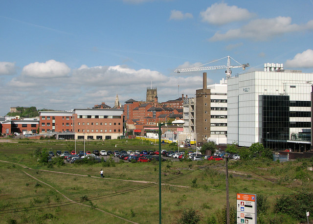
Image: © John Sutton Taken: 16 May 2016
Nottingham Castle is on the skyline on the left, St Mary's Church in The Lace Market in the centre and Biocity to the right in this view from the edge of the Newark Crescent estate which stands on the elevated site of the Manvers Street Goods Depot, built by the London & North Western Railway. Image] shows some of the huge retaining walls which supported the railway yard. The railway line from Grantham to Nottingham Victoria once snaked across the waste land in the foreground on an iron viaduct and brick arches, with the Corporation gas works to its left and Victorian factories to the right.
Images are licensed for reuse under creativecommons.org/licenses/by-sa/2.0
Image Location
Latitude
52.950287
Longitude
-1.137165