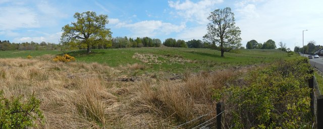
Land opposite Strathleven Estate
Introduction
The photograph on this page of Land opposite Strathleven Estate by Lairich Rig as part of the Geograph project.
The Geograph project started in 2005 with the aim of publishing, organising and preserving representative images for every square kilometre of Great Britain, Ireland and the Isle of Man.
There are currently over 7.5m images from over 14,400 individuals and you can help contribute to the project by visiting https://www.geograph.org.uk

Image: © Lairich Rig Taken: 8 May 2016
See also Image, which shows the same area from the other side of that road. Part of the same road appears on the extreme right in the present picture. At the time of submission of this picture (May 2016), an application had been submitted for a major residential development here. The application was still pending consideration. The two prominent mature trees that are within the proposed development site are both shown in this picture. One is a Sycamore, the other a Pedunculate Oak. At the western boundary of the site (and in the foreground of this picture) is a young hawthorn hedge. A sign that had appeared here by July 2016 gives "Mill Fields" as the name of the development. [The identification of the trees is from one of the documents associated with the planning application.]

