Trott's Almshouses, Cullompton
Introduction
The photograph on this page of Trott's Almshouses, Cullompton by Derek Harper as part of the Geograph project.
The Geograph project started in 2005 with the aim of publishing, organising and preserving representative images for every square kilometre of Great Britain, Ireland and the Isle of Man.

There are currently over 7.5m images from over 14,400 individuals and you can help contribute to the project by visiting https://www.geograph.org.uk
Trott's Almshouses, Cullompton
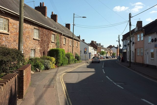
Image: © Derek Harper Taken: 15 May 2016
The listed almshouses are in the sun on the left; they were originally built in 1523 but have been heavily restored https://www.historicengland.org.uk/listing/the-list/list-entry/1306826 . The traffic lights are at the junction with Station Road on the left; both that and the road in the foreground, Higher Street, together with the main road through the town centre ahead, are numbered the B3181, though when Station Road reaches the M5 junction, the A373 takes over.
Images are licensed for reuse under creativecommons.org/licenses/by-sa/2.0
Image Location
Latitude
50.859149
Longitude
-3.392056