Entrance to The Green, Cullompton
Introduction
The photograph on this page of Entrance to The Green, Cullompton by Derek Harper as part of the Geograph project.
The Geograph project started in 2005 with the aim of publishing, organising and preserving representative images for every square kilometre of Great Britain, Ireland and the Isle of Man.

There are currently over 7.5m images from over 14,400 individuals and you can help contribute to the project by visiting https://www.geograph.org.uk
Entrance to The Green, Cullompton
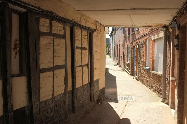
Image: © Derek Harper Taken: 15 May 2016
Another view of Image and the houses and court to which the passage leads. The wall is described at https://www.historicengland.org.uk/listing/the-list/list-entry/1326172 : "he exposed wall of No.26 retains evidence of early screen, with chamfered bressumer, 7 chamfered muntins, 1 door jamb with run-out stop, and original base; later more slender studs and brick infill".
Images are licensed for reuse under creativecommons.org/licenses/by-sa/2.0
Image Location


Leaflet Map data © OpenStreetMap
Latitude
50.856255
Longitude
-3.393391