Below King's Weir
Introduction
The photograph on this page of Below King's Weir by Robin Webster as part of the Geograph project.
The Geograph project started in 2005 with the aim of publishing, organising and preserving representative images for every square kilometre of Great Britain, Ireland and the Isle of Man.

There are currently over 7.5m images from over 14,400 individuals and you can help contribute to the project by visiting https://www.geograph.org.uk
Below King's Weir
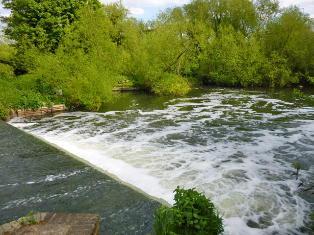
Image: © Robin Webster Taken: 15 May 2016
Visible is the simple second stage of the weir. The view is from River Lee Navigation bridge 49a, an unnavigable footbridge which crosses between the two stages of the weir. The upper stage has a convoluted crest of greater fall.
Images are licensed for reuse under creativecommons.org/licenses/by-sa/2.0
Image Location


Leaflet Map data © OpenStreetMap
Latitude
51.727897
Longitude
-0.013123