Barrhead ROC Bunker: FSM Mount
Introduction
The photograph on this page of Barrhead ROC Bunker: FSM Mount by Lairich Rig as part of the Geograph project.
The Geograph project started in 2005 with the aim of publishing, organising and preserving representative images for every square kilometre of Great Britain, Ireland and the Isle of Man.

There are currently over 7.5m images from over 14,400 individuals and you can help contribute to the project by visiting https://www.geograph.org.uk
Barrhead ROC Bunker: FSM Mount
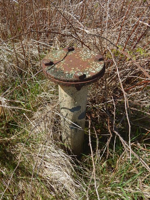
Image: © Lairich Rig Taken: 2 May 2016
For context, and for more information, see Image In that view, this small structure is amongst the tall vegetation on the left, in front of Image This is the FSM Mount (or FSM tube). It supported the Fixed Survey Meter, an instrument that measured ionising radiation (from fallout); wires from the instrument led down through this tube to the underground ROC post.
Images are licensed for reuse under creativecommons.org/licenses/by-sa/2.0
Image Location
Latitude
55.803494
Longitude
-4.405885