Dundry slopes
Introduction
The photograph on this page of Dundry slopes by Neil Owen as part of the Geograph project.
The Geograph project started in 2005 with the aim of publishing, organising and preserving representative images for every square kilometre of Great Britain, Ireland and the Isle of Man.

There are currently over 7.5m images from over 14,400 individuals and you can help contribute to the project by visiting https://www.geograph.org.uk
Dundry slopes
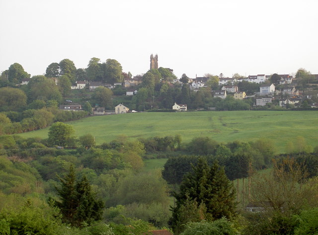
Image: © Neil Owen Taken: 12 May 2016
The ridge of land that Dundry village occupies has some fairly gentle slopes around it except for those immediately north of it. Houses cling to the gradient and take advantage of the fabulous views of Bristol. St Michael's church tower is one of the more prominent landmarks.
Images are licensed for reuse under creativecommons.org/licenses/by-sa/2.0
Image Location
Latitude
51.40093
Longitude
-2.636479