Boundary stone on Highridge Road
Introduction
The photograph on this page of Boundary stone on Highridge Road by Neil Owen as part of the Geograph project.
The Geograph project started in 2005 with the aim of publishing, organising and preserving representative images for every square kilometre of Great Britain, Ireland and the Isle of Man.

There are currently over 7.5m images from over 14,400 individuals and you can help contribute to the project by visiting https://www.geograph.org.uk
Boundary stone on Highridge Road
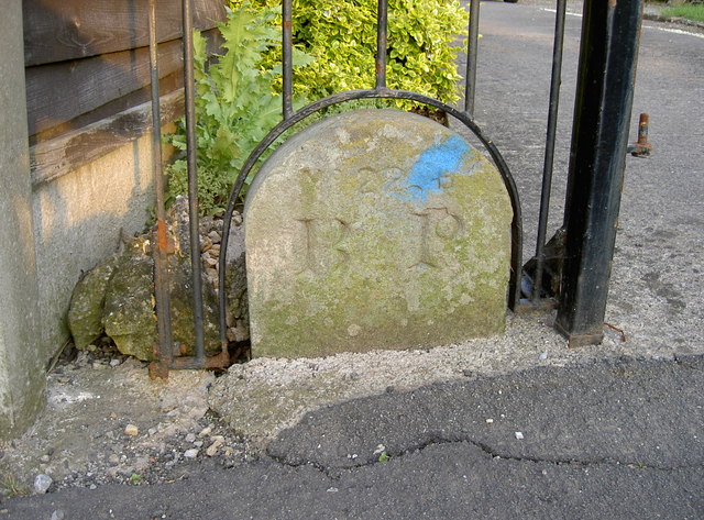
Image: © Neil Owen Taken: 12 May 2016
A boundary stone has been kept and respected by some creative ironmongery. Interestingly, the modern boundaries appear to have been shifted, as this stone is no longer on it. Indeed, the older maps indicate the edge of the city ran through here from centuries ago but were altered post-war as the suburban sprawl increased. Presumably, 'B P' refers to Bishopsworth Parish.
Images are licensed for reuse under creativecommons.org/licenses/by-sa/2.0
Image Location
Latitude
51.410946
Longitude
-2.629861