Hearsall Lane
Introduction
The photograph on this page of Hearsall Lane by E Gammie as part of the Geograph project.
The Geograph project started in 2005 with the aim of publishing, organising and preserving representative images for every square kilometre of Great Britain, Ireland and the Isle of Man.

There are currently over 7.5m images from over 14,400 individuals and you can help contribute to the project by visiting https://www.geograph.org.uk
Hearsall Lane
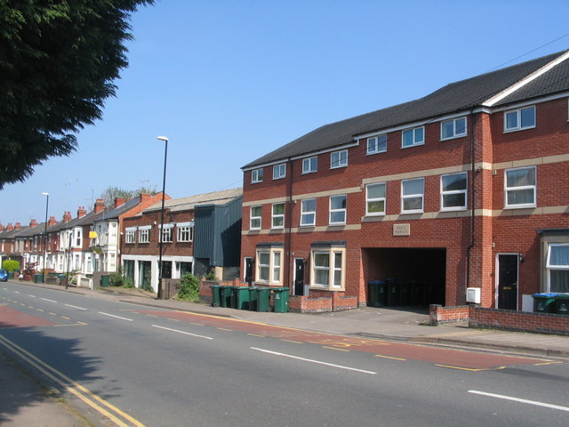
Image: © E Gammie Taken: 12 May 2016
Sandwiched between early 20th century housing on the left and Wells Terrace (constructed 2011/12) on the right is a building which was formerly an industrial photographer's premises but was standing empty when the photo was taken. This is the approximate location of a pound shown on a 1912 Ordnance Survey 1:2,500 map of the area. Stray animals would be held in the pound until claimed by the owners.
Images are licensed for reuse under creativecommons.org/licenses/by-sa/2.0
Image Location
Latitude
52.406728
Longitude
-1.531328