Monken Hadley Common
Introduction
The photograph on this page of Monken Hadley Common by Marathon as part of the Geograph project.
The Geograph project started in 2005 with the aim of publishing, organising and preserving representative images for every square kilometre of Great Britain, Ireland and the Isle of Man.

There are currently over 7.5m images from over 14,400 individuals and you can help contribute to the project by visiting https://www.geograph.org.uk
Monken Hadley Common
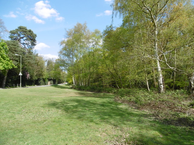
Image: © Marathon Taken: 4 May 2016
Monken Hadley Common is the last remaining fragment of the former Enfield Chase, which was elsewhere enclosed for agriculture in the 18th century. It was originally managed as wood pasture and a number of local people retained ancient Rights of Common, such as stock-grazing rights. Most of the Common is now woodland, although there are areas of acid grassland as here, as well as some ponds. Here Camlet Way leading to Hadley Wood is to the left of the grassland.
Images are licensed for reuse under creativecommons.org/licenses/by-sa/2.0
Image Location
Latitude
51.662214
Longitude
-0.188643