Skipton Road, (south end), Barnoldswick, Yorkshire
Introduction
The photograph on this page of Skipton Road, (south end), Barnoldswick, Yorkshire by Dr Neil Clifton as part of the Geograph project.
The Geograph project started in 2005 with the aim of publishing, organising and preserving representative images for every square kilometre of Great Britain, Ireland and the Isle of Man.

There are currently over 7.5m images from over 14,400 individuals and you can help contribute to the project by visiting https://www.geograph.org.uk
Skipton Road, (south end), Barnoldswick, Yorkshire
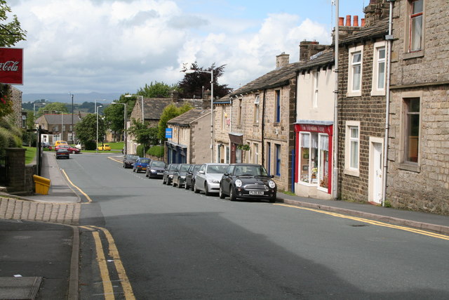
Image: © Dr Neil Clifton Taken: 7 Jul 2007
This shows the extreme south end of Skipton Road, looking northwards away from the Town Centre. The shops on the right are stone roofed and very old. On the left rises St. James' Road (not to be confused with St James' Square), only recently surfaced. Further down on the left is Barnoldswick Church, but not visible here.
Images are licensed for reuse under creativecommons.org/licenses/by-sa/2.0
Image Location
Latitude
53.916297
Longitude
-2.18875