The fence is up
Introduction
The photograph on this page of The fence is up by Richard Sutcliffe as part of the Geograph project.
The Geograph project started in 2005 with the aim of publishing, organising and preserving representative images for every square kilometre of Great Britain, Ireland and the Isle of Man.

There are currently over 7.5m images from over 14,400 individuals and you can help contribute to the project by visiting https://www.geograph.org.uk
The fence is up
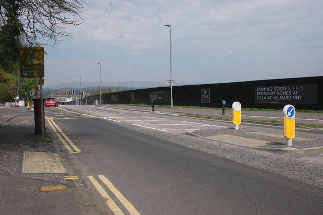
Image: © Richard Sutcliffe Taken: 8 May 2016
The long, black-painted fence is to prevent access onto the construction site for new houses. The fence started to go up in March [http://www.geograph.org.uk/photo/4872992] and now there is secure fencing all round the site, work is beginning. Cala Homes are going to be building 1, 2 and 3 bedroom apartments; and 3, 4 and 5 bedroom homes on the site beside the A81, which used to be a bus company garage.
Images are licensed for reuse under creativecommons.org/licenses/by-sa/2.0
Image Location
Latitude
55.929967
Longitude
-4.316062