Ripe for Development (Rainham)
Introduction
The photograph on this page of Ripe for Development (Rainham) by Glyn Baker as part of the Geograph project.
The Geograph project started in 2005 with the aim of publishing, organising and preserving representative images for every square kilometre of Great Britain, Ireland and the Isle of Man.

There are currently over 7.5m images from over 14,400 individuals and you can help contribute to the project by visiting https://www.geograph.org.uk
Ripe for Development (Rainham)
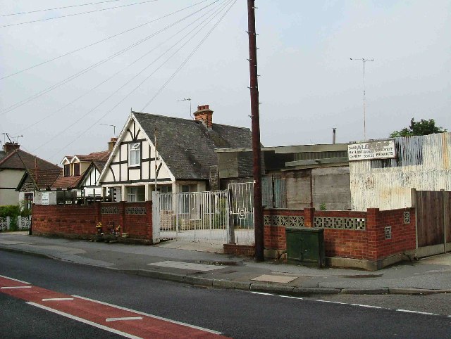
Image: © Glyn Baker Taken: 5 Sep 2005
Surely this apparently derelict builders merchants in Upminster Rd Rainham cannot remain in this state for long? The pressure to build on brown field sites in the Thames corridor is immense. I expect there are queues of property developers knocking at the freeholder’s door! Also in this picture you can see the “shrine” to an 11-year-old girl killed on the road near this spot.
Images are licensed for reuse under creativecommons.org/licenses/by-sa/2.0
Image Location
Latitude
51.522307
Longitude
0.214039