Belle Tout and the Cliffs
Introduction
The photograph on this page of Belle Tout and the Cliffs by Len Williams as part of the Geograph project.
The Geograph project started in 2005 with the aim of publishing, organising and preserving representative images for every square kilometre of Great Britain, Ireland and the Isle of Man.

There are currently over 7.5m images from over 14,400 individuals and you can help contribute to the project by visiting https://www.geograph.org.uk
Belle Tout and the Cliffs
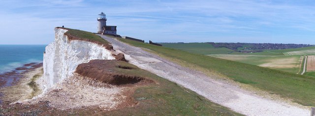
Image: © Len Williams Taken: 5 May 2016
The Belle Tout lighthouse was in danger of falling into the sea so in 1999 the 850 ton lighthouse was moved 17 metres further inland. Clearly further erosion has taken place as the old access road passes too close to the cliff edge. A new road has been constructed to the right of this path. For further details refer to picture Image
Images are licensed for reuse under creativecommons.org/licenses/by-sa/2.0
Image Location
Latitude
50.738248
Longitude
0.214551