Wednesbury from the air
Introduction
The photograph on this page of Wednesbury from the air by M J Richardson as part of the Geograph project.
The Geograph project started in 2005 with the aim of publishing, organising and preserving representative images for every square kilometre of Great Britain, Ireland and the Isle of Man.

There are currently over 7.5m images from over 14,400 individuals and you can help contribute to the project by visiting https://www.geograph.org.uk
Wednesbury from the air
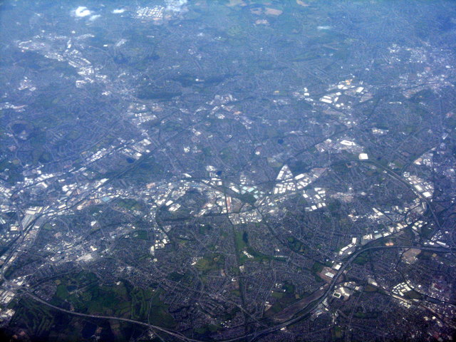
Image: © M J Richardson Taken: 4 May 2016
Looking west from near Royal Sutton Coldfield. A landscape of industrial estates. The stadium at lower right is the home of Walsall FC. The major road at the bottom of the picture is the M5[L] and M6[R] - the M6 continues to the east, 'down' out of the picture.
Images are licensed for reuse under creativecommons.org/licenses/by-sa/2.0
Image Location
Latitude
52.552843
Longitude
-1.986683