Ashfield House, West Cromwell Road
Introduction
The photograph on this page of Ashfield House, West Cromwell Road by Stephen Richards as part of the Geograph project.
The Geograph project started in 2005 with the aim of publishing, organising and preserving representative images for every square kilometre of Great Britain, Ireland and the Isle of Man.

There are currently over 7.5m images from over 14,400 individuals and you can help contribute to the project by visiting https://www.geograph.org.uk
Ashfield House, West Cromwell Road
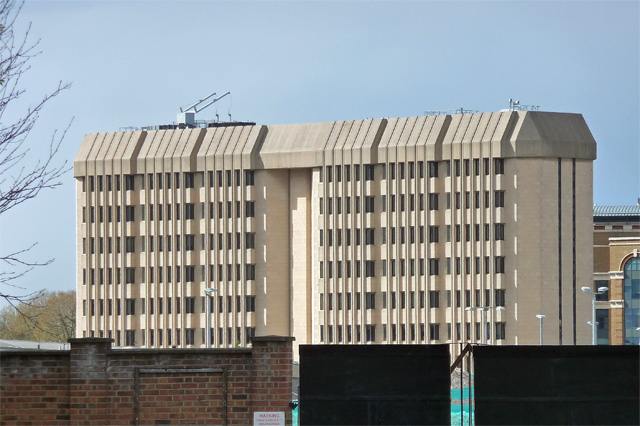
Image: © Stephen Richards Taken: 30 Apr 2016
A fortress-like building, perhaps dating from the late 1970s. Currently offices of Transport for London, its third floor intriguingly contains a fully mocked-up tube station, West Ashfield, used for staff training purposes. A view from Lillie Road which has been opened up by the demolition of Earl's Court.
Images are licensed for reuse under creativecommons.org/licenses/by-sa/2.0
Image Location
Latitude
51.490958
Longitude
-0.203505