Boundary marker on Flowergate
Introduction
The photograph on this page of Boundary marker on Flowergate by J G Harston as part of the Geograph project.
The Geograph project started in 2005 with the aim of publishing, organising and preserving representative images for every square kilometre of Great Britain, Ireland and the Isle of Man.

There are currently over 7.5m images from over 14,400 individuals and you can help contribute to the project by visiting https://www.geograph.org.uk
Boundary marker on Flowergate
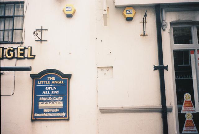
Image: © J G Harston Taken: Unknown
Boundary marker between Whitby and Ruswarp parishes on the boundary between the Little Angel Inn at 18 Flowergate and 19 Flowergate. W R P W=Whitby to the left, R=Ruswarp to the right P=Parish
Images are licensed for reuse under creativecommons.org/licenses/by-sa/2.0
Image Location
Latitude
54.486418
Longitude
-0.616422