
French's Mill
Introduction
The photograph on this page of French's Mill by Tiger as part of the Geograph project.
The Geograph project started in 2005 with the aim of publishing, organising and preserving representative images for every square kilometre of Great Britain, Ireland and the Isle of Man.

There are currently over 7.5m images from over 14,400 individuals and you can help contribute to the project by visiting https://www.geograph.org.uk
French's Mill
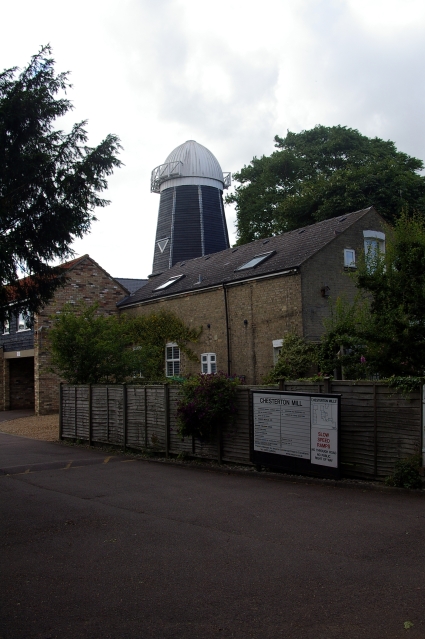
Image: © Tiger Taken: 6 Jul 2007
Also known as Chesterton Mill, this smock mill, now devoid of its sails, is hidden away at the end of French's Road. It is the last surviving windmill in the city, though there are three just beyond the boundary at: Fulbourn Image Impington Image Madingley Image). The maltster William Beart built the mill in 1847, but sadly died shortly afterwards. William French then acquired a lease on the property and in 1850 was able to buy the freehold (including a granary, stables, a cottage for the miller and half an acre of ground) at public auction for £440. The mill was successively converted to steam, gas and finally diesel power but continued to grind corn until 1956, and the buildings were converted into offices during the early 1980s. For a closer view of the tower with its brick base see Image French's Mill is listed Grade II https://britishlistedbuildings.co.uk/101337012-windmill-at-chesterton-mills-cambridge Chesterton Mill website https://www.chestertonmill.com/
Images are licensed for reuse under creativecommons.org/licenses/by-sa/2.0
Image Location

Latitude
52.218801
Longitude
0.114561