Glusburn Institute, Glusburn
Introduction
The photograph on this page of Glusburn Institute, Glusburn by Stephen Richards as part of the Geograph project.
The Geograph project started in 2005 with the aim of publishing, organising and preserving representative images for every square kilometre of Great Britain, Ireland and the Isle of Man.

There are currently over 7.5m images from over 14,400 individuals and you can help contribute to the project by visiting https://www.geograph.org.uk
Glusburn Institute, Glusburn
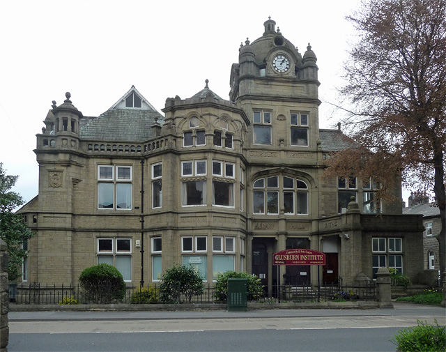
Image: © Stephen Richards Taken: 17 May 2013
By F.W. Petty for John Cousen Horsfall who developed a model industrial village here from c1890. Originally the building housed a library, theatre and public baths. Many idiosyncratic features not entirely happily blended together. Grade II listed. Hearteningly, still a community centre.
Images are licensed for reuse under creativecommons.org/licenses/by-sa/2.0
Image Location
Latitude
53.899189
Longitude
-1.999659