London Underground Map c.1910
Introduction
The photograph on this page of London Underground Map c.1910 by Ian Taylor as part of the Geograph project.
The Geograph project started in 2005 with the aim of publishing, organising and preserving representative images for every square kilometre of Great Britain, Ireland and the Isle of Man.

There are currently over 7.5m images from over 14,400 individuals and you can help contribute to the project by visiting https://www.geograph.org.uk
London Underground Map c.1910
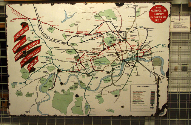
Image: © Ian Taylor Taken: 23 Apr 2016
An example of the many signs at the London Transport Museum Depot. Clearly, this pre-dates Harry Beck's classic design and the formation of the London Passenger Transport Board in 1933. The only football grounds shown are Brentford, Chelsea and Fulham.
Images are licensed for reuse under creativecommons.org/licenses/by-sa/2.0
Image Location
Latitude
51.504357
Longitude
-0.281508