Zone for leisure - Ladywood, Birmingham
Introduction
The photograph on this page of Zone for leisure - Ladywood, Birmingham by Martin Richard Phelan as part of the Geograph project.
The Geograph project started in 2005 with the aim of publishing, organising and preserving representative images for every square kilometre of Great Britain, Ireland and the Isle of Man.

There are currently over 7.5m images from over 14,400 individuals and you can help contribute to the project by visiting https://www.geograph.org.uk
Zone for leisure - Ladywood, Birmingham
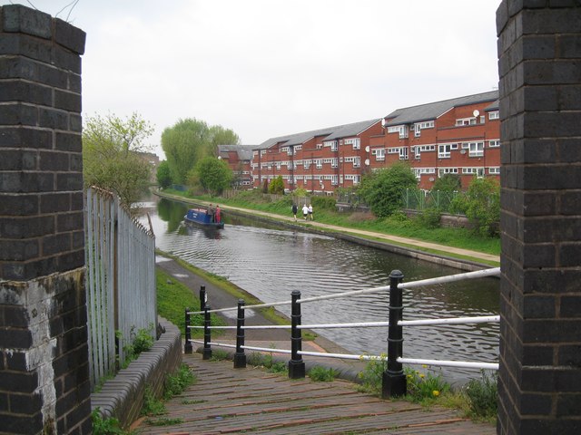
Image: © Martin Richard Phelan Taken: 2 May 2012
The Industrial Revolution and the need to move goods more easily gave rise to the canal system. One horse-towed narrowboat could carry a load far greater than say 20 - 30 packhorses. Canals lay dormant for a number of years but the founding of the IWA (Inland Waterways Association) from a meeting between Robert Aickman and Tom Rolt at Tardebigge in August 1945 helped towards a revival of interest in these neglected routes for leisure. In Birmingham and other areas of Britain there are now facilities for walking, cycling and for cruising along these waterways, these traffic-free routes for the enjoyment of all, as in this view from the St Vincent Street Bridge, Birmingham. Time photo taken 12.28 pm BST (British Summer Time).
Images are licensed for reuse under creativecommons.org/licenses/by-sa/2.0
Image Location
Latitude
52.47973
Longitude
-1.921919