Doseley Road under the railway bridge
Introduction
The photograph on this page of Doseley Road under the railway bridge by Richard Law as part of the Geograph project.
The Geograph project started in 2005 with the aim of publishing, organising and preserving representative images for every square kilometre of Great Britain, Ireland and the Isle of Man.

There are currently over 7.5m images from over 14,400 individuals and you can help contribute to the project by visiting https://www.geograph.org.uk
Doseley Road under the railway bridge
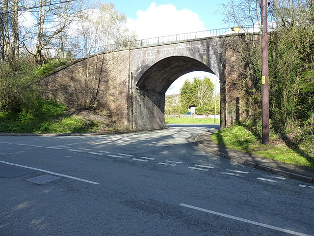
Image: © Richard Law Taken: 16 Apr 2016
Leaving St Lukes Road in Doseley, the minor road heads for Dawley under a bridge that currently marks the southern end of the Telford Steam Railway Trust's line and operations. It was built around 1858, and originally served a track from Ketley down to Lightmoor as part of the Wellington & Severn Junction Railway. Grade II listed https://britishlistedbuildings.co.uk/101257696-railway-bridge-west-of-cheshire-cheese-public-house-dawley-hamlets & https://historicengland.org.uk/listing/the-list/list-entry/1257696 in 1997
Images are licensed for reuse under creativecommons.org/licenses/by-sa/2.0
Image Location
Latitude
52.657063
Longitude
-2.477023