Heritage Plaque on Detroit Bridge
Introduction
The photograph on this page of Heritage Plaque on Detroit Bridge by David Dixon as part of the Geograph project.
The Geograph project started in 2005 with the aim of publishing, organising and preserving representative images for every square kilometre of Great Britain, Ireland and the Isle of Man.

There are currently over 7.5m images from over 14,400 individuals and you can help contribute to the project by visiting https://www.geograph.org.uk
Heritage Plaque on Detroit Bridge
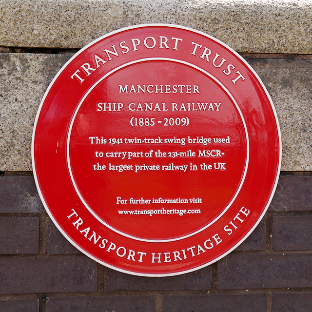
Image: © David Dixon Taken: 21 Apr 2016
This red plaque, affixed to Image], records that the bridge, built in 1941, used to carry part of the Manchester Ship Canal Railway, the largest private railway in the UK. The 80-metre long former railway bridge was moved and converted to a footbridge during the redevelopment of Salford Docks as they were transformed into Salford Quays. The bridge now crosses the Huron and Erie Basins, linking the residential area around Ontario Basin with Harbour City and MediaCityUK.
Images are licensed for reuse under creativecommons.org/licenses/by-sa/2.0
Image Location
Latitude
53.473064
Longitude
-2.292083