
Sighthill high rise demolition & contamination
Introduction
The photograph on this page of Sighthill high rise demolition & contamination by david cameron photographer as part of the Geograph project.
The Geograph project started in 2005 with the aim of publishing, organising and preserving representative images for every square kilometre of Great Britain, Ireland and the Isle of Man.

There are currently over 7.5m images from over 14,400 individuals and you can help contribute to the project by visiting https://www.geograph.org.uk
Sighthill high rise demolition & contamination
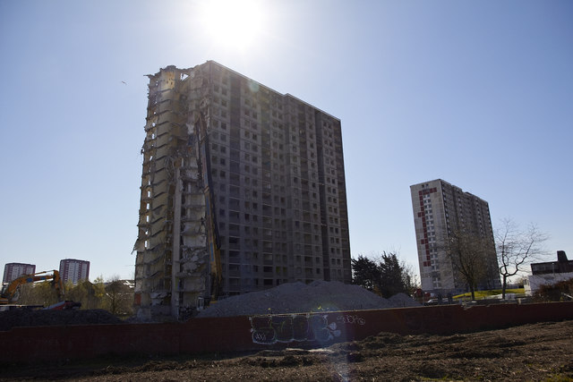
Image: © david cameron photographer Taken: 21 Apr 2016
There’s a terrible smell all over Glasgow’s Sighthill Park and while one worker drilled into the ground he told me the land is contaminated as black stinking sludge came out of the ground. It looks like burst sewage pipes are to blame for the gigantic mess judging by all the scarring of the land. While in the background demolition teams set about removing one of the last two high rise tower blocks along the main road. You’ll find other images here : https://www.flickr.com/photos/its-all-pretty-cool_dot-com/albums/72157667353959801
Images are licensed for reuse under creativecommons.org/licenses/by-sa/2.0
Image Location

Latitude
55.873186
Longitude
-4.237226