Pre-Worboys road sign, Whetsted Road, Whetsted
Introduction
The photograph on this page of Pre-Worboys road sign, Whetsted Road, Whetsted by Chris Whippet as part of the Geograph project.
The Geograph project started in 2005 with the aim of publishing, organising and preserving representative images for every square kilometre of Great Britain, Ireland and the Isle of Man.

There are currently over 7.5m images from over 14,400 individuals and you can help contribute to the project by visiting https://www.geograph.org.uk
Pre-Worboys road sign, Whetsted Road, Whetsted
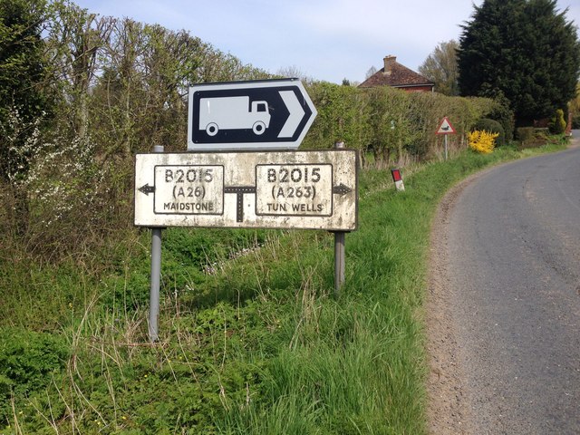
Image: © Chris Whippet Taken: 21 Apr 2016
This sign is certainly of some vintage, the approaching road has not been classified as the B2015 for several years, and the A263 disappeared decades ago.
Images are licensed for reuse under creativecommons.org/licenses/by-sa/2.0
Image Location


Leaflet Map data © OpenStreetMap
Latitude
51.187885
Longitude
0.368416