Church of St Catherine, Drayton
Introduction
The photograph on this page of Church of St Catherine, Drayton by Derek Harper as part of the Geograph project.
The Geograph project started in 2005 with the aim of publishing, organising and preserving representative images for every square kilometre of Great Britain, Ireland and the Isle of Man.

There are currently over 7.5m images from over 14,400 individuals and you can help contribute to the project by visiting https://www.geograph.org.uk
Church of St Catherine, Drayton
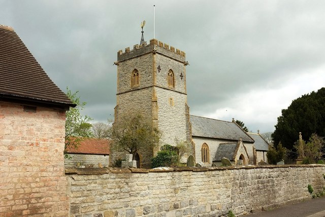
Image: © Derek Harper Taken: 16 Apr 2016
The grade I listed church, seen from Church Street, is described at https://www.historicengland.org.uk/listing/the-list/list-entry/1236512 . On the right, topped by a ball finial, is the grade II* lasted churchyard cross, described at https://www.historicengland.org.uk/listing/the-list/list-entry/1236539 and at https://www.historicengland.org.uk/listing/the-list/list-entry/1018637 .
Images are licensed for reuse under creativecommons.org/licenses/by-sa/2.0
Image Location


Leaflet Map data © OpenStreetMap
Latitude
51.019121
Longitude
-2.849651