Comberton
Introduction
The photograph on this page of Comberton by Tom Pullman as part of the Geograph project.
The Geograph project started in 2005 with the aim of publishing, organising and preserving representative images for every square kilometre of Great Britain, Ireland and the Isle of Man.

There are currently over 7.5m images from over 14,400 individuals and you can help contribute to the project by visiting https://www.geograph.org.uk
Comberton
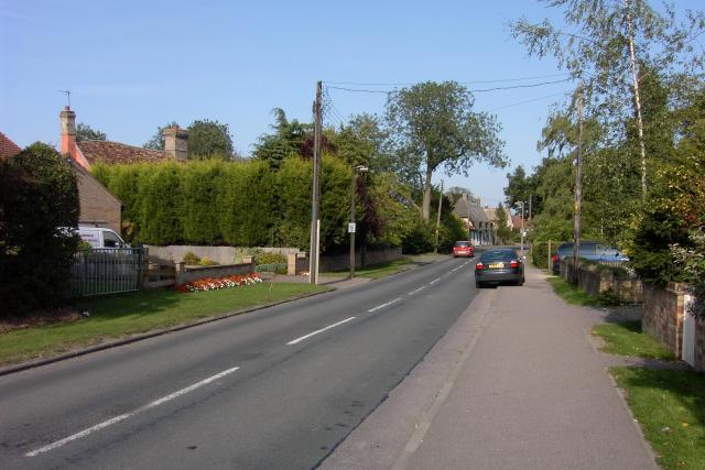
Image: © Tom Pullman Taken: 4 Sep 2005
Looking ENE along the B1046 coming into Comberton from Toft. There is a great mix of ages of housing within the SE corner of this square - some houses look to be hundreds of years old (such as the pink one with the somewhat bent roof visible over the hedge on the left) while others must have been built within the last few decades.
Images are licensed for reuse under creativecommons.org/licenses/by-sa/2.0
Image Location


Leaflet Map data © OpenStreetMap
Latitude
52.185938
Longitude
0.014255