Alfred Gelder Street, Kingston upon Hull
Introduction
The photograph on this page of Alfred Gelder Street, Kingston upon Hull by Bernard Sharp as part of the Geograph project.
The Geograph project started in 2005 with the aim of publishing, organising and preserving representative images for every square kilometre of Great Britain, Ireland and the Isle of Man.

There are currently over 7.5m images from over 14,400 individuals and you can help contribute to the project by visiting https://www.geograph.org.uk
Alfred Gelder Street, Kingston upon Hull
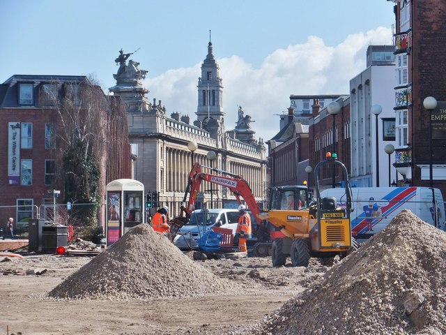
Image: © Bernard Sharp Taken: 8 Apr 2016
As Kingston upon Hull gets ready to host 'UK City of Culture 2017', 'Destination Hull 2017 and beyond' is the biggest regeneration programme the city has ever seen. Depicted are works being undertaken in Carr Lane between the Town Docks Museum and Beverley Gate. Background, left to right: The Wilson Centre (one of the Council's Customer Service Centres), the Guildhall (seat of the city's local government), various commercial buildings, south side of Alfred Gelder Street.
Images are licensed for reuse under creativecommons.org/licenses/by-sa/2.0
Image Location
Latitude
53.744349
Longitude
-0.334147