OS bolt and benchmark - Haughton, St Gile's church
Introduction
The photograph on this page of OS bolt and benchmark - Haughton, St Gile's church by Richard Law as part of the Geograph project.
The Geograph project started in 2005 with the aim of publishing, organising and preserving representative images for every square kilometre of Great Britain, Ireland and the Isle of Man.

There are currently over 7.5m images from over 14,400 individuals and you can help contribute to the project by visiting https://www.geograph.org.uk
OS bolt and benchmark - Haughton, St Gile's church
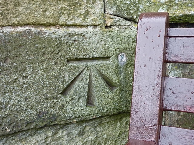
Image: © Richard Law Taken: 9 Apr 2016
A 1st Primary Levelling bolt, and associated more recent cutmark, on the south face of the church tower. It was placed in late 1858 as part of the Llandysilio to Stafford levelling line at a height of 346' 7.5" above Ordnance Datum Liverpool.
Images are licensed for reuse under creativecommons.org/licenses/by-sa/2.0
Image Location
Latitude
52.781442
Longitude
-2.201112