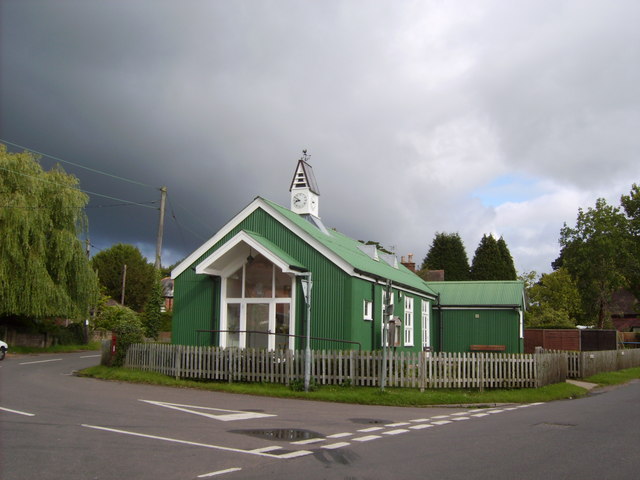
Bartley Tin Church
Introduction
The photograph on this page of Bartley Tin Church by Val Pollard as part of the Geograph project.
The Geograph project started in 2005 with the aim of publishing, organising and preserving representative images for every square kilometre of Great Britain, Ireland and the Isle of Man.
There are currently over 7.5m images from over 14,400 individuals and you can help contribute to the project by visiting https://www.geograph.org.uk

Image: © Val Pollard Taken: 10 Jul 2007
Built in 1900 it remained a Church of England Church until 1992. It has since been bought by a Charitable Trust, renovated and is now a Village Hall and centre for the community. History at: www.hants.gov.uk/bartleytinchurch/history1.htm Information on this type of Church, known as a 'Tin Tabernacle' can be found at this link: http://www.buildingconservation.com/articles/tin-tabernacles/tin-tabernacles.html including the fact that by 1875 hundreds of prefabricated corrugated iron buildings were being mass produced and made available for sale through catalogues. Each building type – cottage, railway station, church or house – was illustrated with a drawing and a price. Size could be altered according to need.

