Former route of A660 near Burley
Introduction
The photograph on this page of Former route of A660 near Burley by David Spencer as part of the Geograph project.
The Geograph project started in 2005 with the aim of publishing, organising and preserving representative images for every square kilometre of Great Britain, Ireland and the Isle of Man.

There are currently over 7.5m images from over 14,400 individuals and you can help contribute to the project by visiting https://www.geograph.org.uk
Former route of A660 near Burley
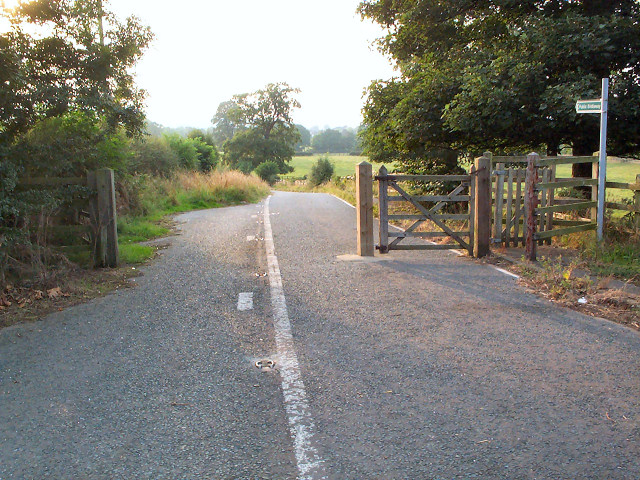
Image: © David Spencer Taken: 4 Sep 2005
Complete with original road markings and catseye studs, this bridleway was the old narrow version of the main A660 road from Ilkley to Leeds. Seen near the Orange cellphone mast looking westwards. The replacement road is a single carriageway that boldly goes across the Wharfe's floodplain.
Images are licensed for reuse under creativecommons.org/licenses/by-sa/2.0
Image Location


Leaflet Map data © OpenStreetMap
Latitude
53.909278
Longitude
-1.730776